Digital twins & marine simulation

Building a marine digital twin, starting with simulation

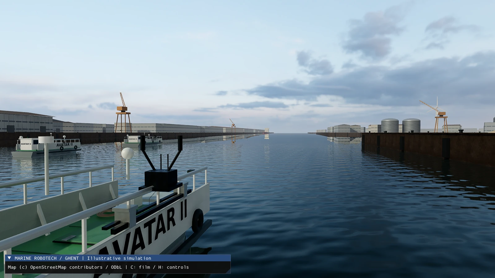
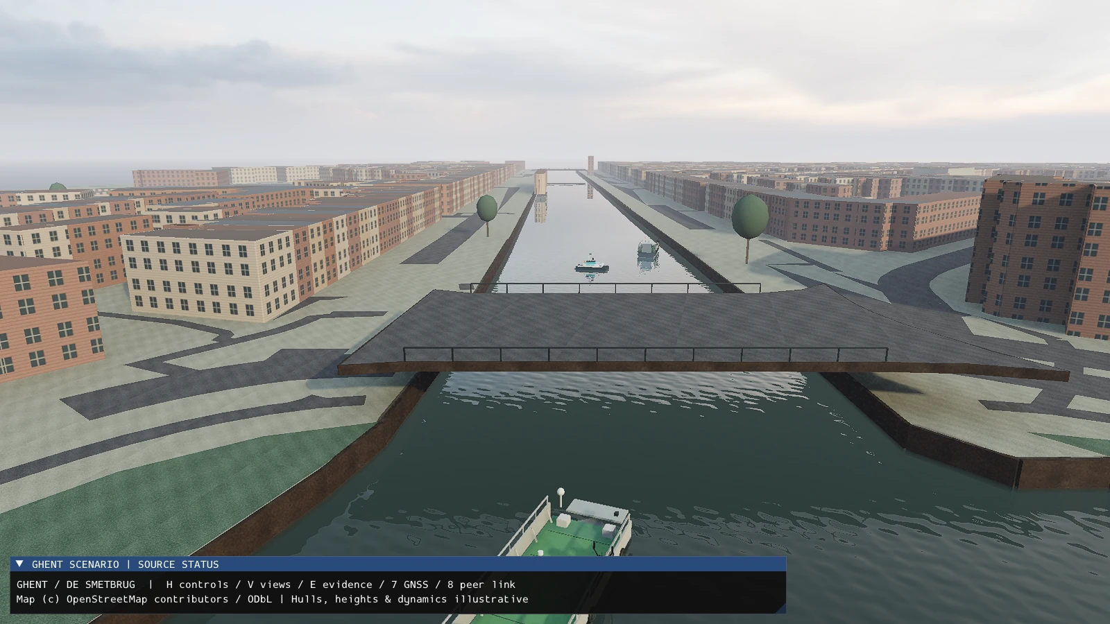
An AI-assisted 3D prototype makes vessel routes, leader–follower movement and port scenarios visible, providing a starting point for sensor integration and pilot discussions.

Ghent / North Sea Port · Marine RoboTechOctober 2026Working visual simulation prototype
Ghent USV demonstration · 30 seconds · Silent video

A moving camera follows AVATAR III and AVATAR II through an illustrative port scene. Amber dashes show the planned route; cyan and purple lines show the lead and following vessels’ simulated tracks.

Illustrative simulation · Synthetic vessel motion · Live telemetry integration planned

Map data © OpenStreetMap contributors · Visual asset credits

The opportunity

How can a vessel concept become clear enough for operators, engineers and partners to discuss before committing to an on-water pilot?

My contribution

I defined the marine use case and guided AI-assisted development of a threepp simulation, drawing on my remote-operation and Marine Awareness work. I shaped the Ghent port scenario, vessel presentation, route displays and demonstration sequence, and reviewed the result against the intended operating context.

Concrete output

A native 3D simulation prototype, a 30-second demonstration video and port-view renders. The video shows a lead vessel and a following vessel, an amber planned route, and cyan and purple tracks generated by the simulation. The wider prototype includes illustrative route, docking-approach and communication-loss scenarios.

Evidence summary

What is demonstrated, and what comes next

FocusWorking summary
Scenario visualisationWorking 3D port and bridge scenes with simplified vessel geometry.
Vessel movementSimulated lead and following vessels; a planned route and colour-coded tracks.
Demonstration designCamera sequencing, readable route labels and a shareable 30-second video.
Live digital twinPlanned: measured telemetry, sensor observations, data-quality indicators and mission replay.
Operational validationPlanned: calibration, vessel trials, communication-loss recovery and bounded onboard autonomy.

A concise summary of the case material, prepared for this portfolio.

Business relevance

A visual prototype gives technical and commercial partners something concrete to examine: the intended workflow, information an operator needs, and the interfaces a pilot would require. It supports early requirements discussions and demonstration planning; operational benefits still need to be measured in trials.

Supporting evidence

Original prototype output · October 2026

Ghent USV simulation demonstration

A 30-second screen recording from the threepp-based prototype. Shows synthetic vessel motion and route traces; it contains no live vessel or sensor data.

Open the demo video ↗
Related hands-on integration work

Marine Awareness prototype

The existing LiDAR, camera and IMU prototype provides a separate starting point for future integration with the digital twin. Its current stage is documented in the perception case.

Explore Marine Awareness ↗

Attribution

Map and visual asset credits

Map data © OpenStreetMap contributors, ODbL. Sky and concrete materials: Poly Haven, CC0. Rendered vessel and scenario geometry were created for the prototype.

View asset credits ↗
Current stage

The current output is an illustrative simulation and a step toward a connected digital twin. Vessel motion and tracks are synthetic; hull dimensions, elevations and dynamics are simplified. It is not a surveyed port model, a replay of a real trial or a validated navigation system. Live vessel telemetry and Marine Awareness sensors are not connected.

The next step

Connect measured position, heading and motion from the vessel; add Marine Awareness observations, data-age indicators and mission replay. Future operator-interface work will consider OpenBridge. Communication-loss recovery and onboard autonomous control remain development and validation objectives.